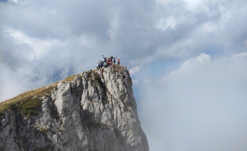
Maglić is a Dinaric mountain located on the border between Bosnia and Herzegovina (Republika Srpska) and Montenegro. The highest peak of the mountain, at 2,388 meters, is situated on the territory of Montenegro, while the highest peak in Bosnia and Herzegovina is also named Maglić and stands at 2,386 meters.
Maglić Mountain is located about 20 kilometers southwest of Foča, along the border between Bosnia and Herzegovina and Montenegro. It is bordered by the Sutjeska River to the west, the Volujak Mountain to the southwest, the Drina, Piva, and Tara rivers to the northeast, and the Bioč Mountain to the southeast. The mountain is covered with beech and coniferous forests, with the upper tree line reaching around 1,600 meters. Above this elevation lies a plateau with pastures, numerous ridges, and peaks. The most well-known highland areas include Vučevo, Rujevac, Sniježnica, Prijevor, and Mratinjska Gora. At the foot of Maglić is Perućica, the largest primeval forest in Europe, as well as a large glacial cirque with Trnovačko Lake at 1,517 meters above sea level. The mountain’s base and slopes are rich in water, with many springs, among which the Carev Do spring never runs dry.
Ahead of you is a three-day adventure that combines challenge, adrenaline, natural beauty, and what we love the most – great company and moments you’ll remember for a long time!